Requirement Analysis
Contributed to functional and non-functional requirements and the overall system concept.
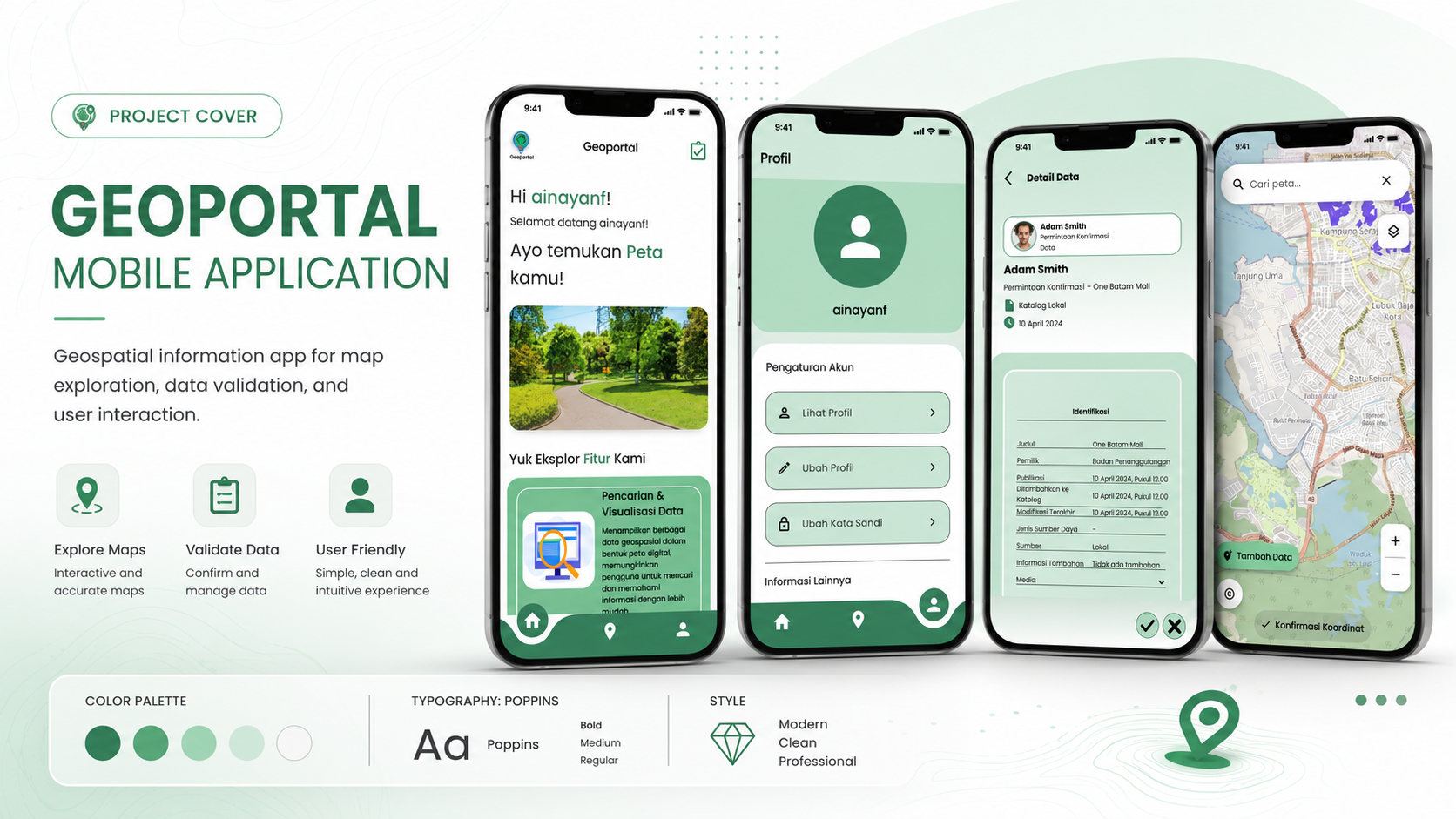
A mobile geographic information system designed to provide accessible and centralized spatial information about housing, settlements, infrastructure, and public utilities in Batam.
Add geoportal cover.png
Project Overview
Geoportal Perkimtan was developed to centralize housing and settlement data and make spatial information easier to access through mobile devices.
The application presents an interactive map, location information, housing data, infrastructure information, and public utility data to support planning and evaluation in Batam.
My Contribution
Contributed to functional and non-functional requirements and the overall system concept.
Created use cases, use case scenarios, ERD, and the relational database schema.
Created wireframes, high-fidelity mockups, and an interactive application prototype.
Implemented several user interfaces and application flows using Flutter.
Prepared application testing documentation and supported product evaluation.
Produced the application demo video and contributed to the final PBL report.
Main Features
Features designed for both public users and application administrators.
Secure registration and login using Firebase Authentication.
View housing and settlement information through an interactive spatial map.
Search available locations and access detailed spatial information.
Access centralized housing, infrastructure, and public utility data.
Users can submit general information and spatial data through the application.
Add and manage coordinate data associated with housing and settlement objects.
Administrators can review, approve, or reject submitted user data.
Upload and manage supporting images and documents using cloud storage.
Technology Stack
Cross-platform framework used to build the mobile interface.
Primary programming language used throughout the application.
Used for NoSQL data management and real-time application data.
Manages secure user registration and authentication.
Cloud storage for images, documents, and supporting files.
Primary code editor used during application development.
Project Gallery
Explore four main interface showcases from the Geoportal Perkimtan mobile application.
Explore More